Our local expert reveals two top-notch trails in Seattle’s backyard.
This week, we’ll showcase two very popular bike loops in the Mt. Rainier area. With at least two trails each, these rides should keep you busy for a while.

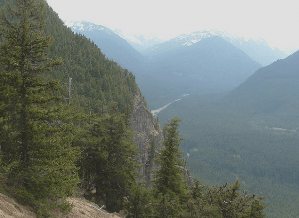
- Suntop Fire Lookout. Photo: Flickr/Photomattick
Suntop/Skookum Flats Loop — Mt. Baker-Snoqualmie National Forest
Why It’s Great: This is one of the most popular mountain bike trails in Washington. It combines the speed of singletrack, the technicality of backcountry riding and the endurance of trail climbing.
Trail Notes: Suntop starts off with a grueling 5.7-mile, 3,000-ft. ascent up a gravel road that will get you in shape quickly. You can also ride up to the lookout (another one-mile/1,000-ft. climb), where you will find a spectacular view of Mt. Rainier. There is parking at the top if you prefer to shuttle, which is more than understandable.
From there, look for the Suntop trail head (trail #1183) on the left before the parking area. Follow this trail all the way down for about eight miles of smooth, fast singletrack riding with beautiful scenery. Eventually, you will come out at a parking area, where the beginning of the Skookum Flats trail (#1194) is located. This trail is much more technical, and will keep you on your toes for the duration of this 5.5-mile ride.
Please note that there have been reports of snow still at the top of this trail, so you will want to prepare accordingly.
Length: 21 miles
Driving Directions: From Enumclaw, drive East on Highway 410. After about 30 miles, keep your eyes out for USFS Road 73 on the right, just after mile marker 49. Turn right on 73, cross the bridge and immediately turn right into the lower Skookum Flats parking area (NW Forest Pass required). If you have two cars, you can drive a second car to the top of Suntop (the junction is less than one mile away, on the left) and then ride back down to your first car. Otherwise, just go right as you ride your bike out of the parking lot. View a map here.
Contact: Enumclaw Ranger Station | 450 Roosevelt, Enumclaw | (360) 825-6585 x0

Ranger Creek/Palisades Loop — Mt.Baker-Snoqualmie National Forest
Why It’s Great: The Palisades is a very technical singletrack trail with multiple switchbacks that can be challenging, but the views and the speed of this trail make it well worth it.
Trail Notes: Ranger Creek (#1197) also starts off with a demanding climb, but the ride down is worth it. Start on road #72 and follow that climb. After about 6.5 miles you will reach the Ranger Creek Shelter, which is where the Palisades trailhead is located (#1198). You will emerge from the forest alongside Highway 410, which will take you back to the parking lot. There are also many other trails that branch off of this one that are worth checking out, so buy a map or do some research online to plan out your own perfect ride.
Length: 12.5 miles
Driving Directions: Follow SR 167 South to SR 410 East for 38.2 miles to Forest Service Road 72. Turn left, go 50 yards and park on the right side of the road at a small pull-out. View a map here.
Note: These trails are unsupervised, so RIDE AT YOUR OWN RISK! Be sure to wear proper clothing and protective gear, pack plenty of water, a first-aid kit, bike tools and sunscreen, and never ride alone. Contact local ranger stations for further information and definitely travel with a map.
Contact: Enumclaw Ranger Station | 450 Roosevelt Ave, Enumclaw | (360) 835-6565 x0
